About Connections: Love it or hate it, history is a map. Those who hate history think it irrelevant; many who love history think it escapism. In truth, history is the clearest road map to how we got here: America in the 21st century.
Prior to 1761, when Great Barrington was still the North Parish of Sheffield, the center of town was on Pixley Street. (Today, that is the stretch of Route 7 immediately over the Great Barrington bridge.) Of the original 22 settlement families, few lived south of the bridge. In addition to the houses, all major buildings were on Pixley — the first meetinghouse, Root tavern, the mills and the cemetery (still there today). At that time, Main Street was one of many footpaths through the woods. Later, the most traveled of these footpaths became cart roads (a roadbed the width of cartwheels).
In 1744, the great bridge spanning the Housatonic was built, and the road leading to it — Main Street — was widened to 2 rods (33 feet). However, it was not yet the main drag. Travel was impaired because it was crisscrossed by rivulets and ran beside a swamp. A mist rose from the swamp, and the emanation was considered ghostly. The road was declared haunted; therefore travel on it, especially at night, was ill-advised.
From 1761-75, the population of Great Barrington almost doubled. It grew from 500 to 961 residents in 128 dwellings. During that time, an increasing number of both residences and public structures were built on Main Street. There were two churches, one school and a number of taverns.
In 1765, four years after Great Barrington was incorporated, it was named the Berkshire shire town (county seat). The new courthouse with jail was built on Main Street near the Castle Street intersection. Houses, churches, taverns were built around it. The number of taverns was considered “disproportionately high for the total population.” Even the courthouse had a tavern. Slowly Main Street overtook Pixley Street as the Great Barrington hub. Evidently, nothing said “town center” like a courthouse and a jail doing double duty as a tavern.
Still in 1777, a German officer arrived in Great Barrington and condemned Main Street as a “miserable rocky and stony road through woods.”
At the turn of the century (1800), to improve the look of Main Street, settlers planted elm trees. Still the roadbed was narrow and dusty where it was not narrow and muddy. Changes were proposed. A wider public way (10 rods equals 165 feet) would allow for a sidewalk and hitching posts as well as a wider roadbed. However, money was tight and there was opposition. All that expensive work, it was said, would be too fancy and not suited “for the needs of our rural town.”
On Christmas Eve 1825, two enterprising Great Barrington residents — Ralph Taylor and William Cullen Bryant — walked the street and counted the rigs. There were 300 rigs hitched to trees, posts and fences. Some were pulled out of the roadbed but others blocked it. Taylor and Bryant were collecting statistics to demonstrate that Great Barrington had a major parking problem on Main Street.
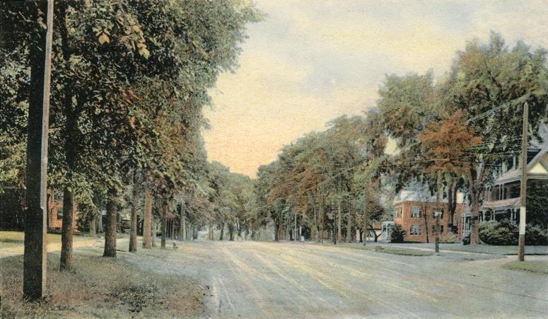
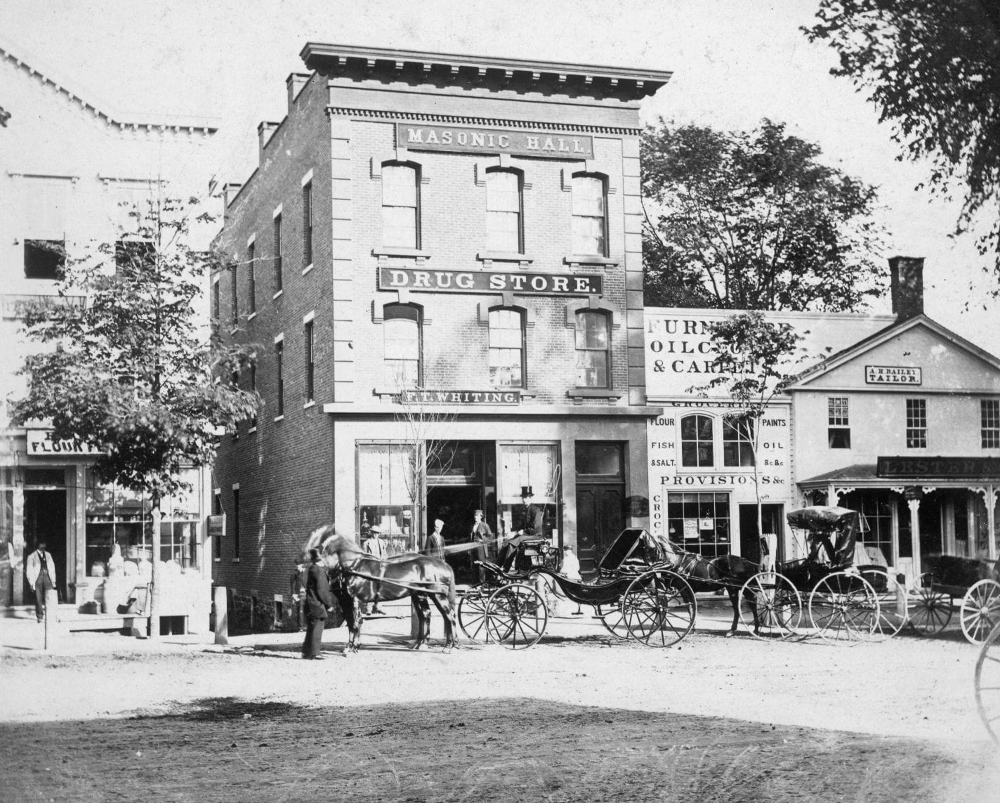
In 1882, Main Street was declared “picturesque” even though it was still a dirt roadway patched with gravel. Moreover, the century-old elms overarching and shading Main Street were dying. Any suggestion that Main Street be improved met with resistance until 1890. That year a loaded lumber wagon sank into a hole on Main Street directly in front of Town Hall. In 1895 the Commonwealth cited Great Barrington’s Main Street as dirty and dangerous. So finally, in 1898, all projections into the sidewalks were removed. In 1899 hitching posts were removed. It was 1904 before Main Street was widened and paved. The improvements were considered to be in response to the Commonwealth’s 1895 citation even though it was almost a decade later.
The 1909 Advisory Committee Report put on the brakes: “Within the last five years … we have expended for paving Main Street … over $60,000 per mile, and [the paved street] costs much more to keep in repair than does a good macadam, cinder, or gravel road … it is hoped that no further appropriation for expensive street paving be entertained …”
The committee stated its reason for the advice: “Taxes in our town are heavy, and during these years of general business depression, when trade is dull and many … laborers are but partially employed, [we cannot] bear with this excessive weight upon us.”
The coup de gras of the 1909 report was as follows: “Many of us remember when, in 1896, $700 was appropriated for the care of Main Street from the Mahaiwe Cemetery to the Great Bridge … the whole street was cleaned up and kept clean in most admirable condition … and at the end of the year $346.28 was returned to the town … It is our opinion that macadam, gravel or cinder, well laid and kept in repair, is the cheapest and most suitable road for the needs of our rural town.”
Over the objections, in 1909, Main Street was repaved, the sidewalks got curbs and the roadbed was raised. In 1910 a business sued the town for damage to its business caused by runoff from the raised road. In 1912, $1,500 was appropriated for “grading Main Street” to lower the roadbed.
Over more than 200 years, improvements to Main Street from footpath to paved road caused discussion, discord and lawsuits. The individual circumstances changed, but the underlying debate was always the same: Were the changes proposed well-suited or ill-suited “for the needs of our rural town”?